
Lake Texcoco was the salt lake around Tenochtitlán, the Aztec capital founded in 1325. Mexico City grew over much of its former bed, but water and wetlands remain east of the city. The historical map below shows the old lake system; the modern ecological park is a separate place to visit.
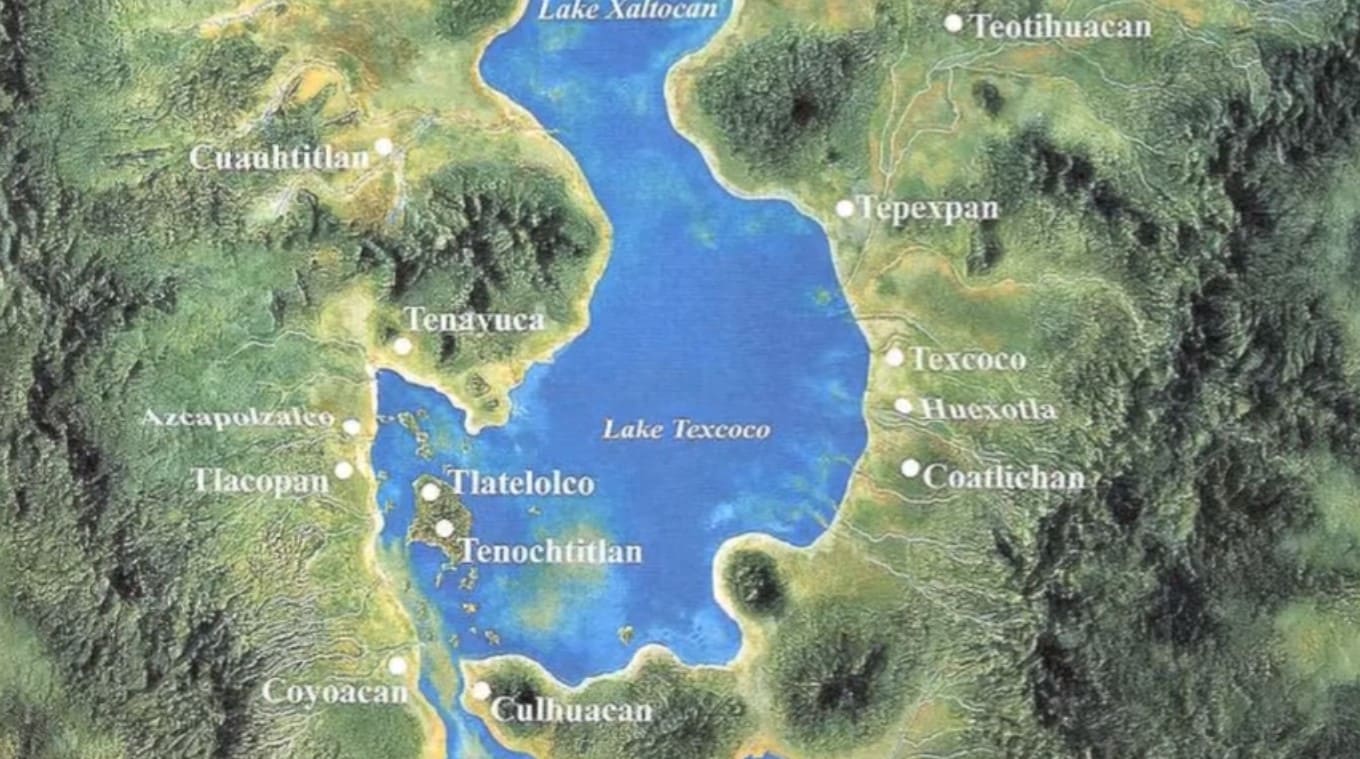
Lake Texcoco: size, depth and location
There is no single depth or shoreline that describes Texcoco throughout its history. The Mexican culture ministry’s museum profile gives about 600 km² and 11 metres deep for the pre-Hispanic lake. It does not identify that depth as an average or a maximum. These are historical figures, not measurements of today’s park ponds.
| Location | Valley of Mexico, beneath and east of present-day Mexico City |
|---|---|
| Historic lake system | Texcoco, Zumpango, Xaltocan, Xochimilco and Chalco |
| Water | Saline in Texcoco; freshwater areas were separated by dikes |
| Present landscape | Urban areas, remaining wetlands, managed water bodies and the ecological park |
The lake that became Mexico City — and why it was salty
Tenochtitlán occupied an island in a closed basin: water arrived, but had no natural route to the sea. Evaporation left salts behind. The dike associated with Nezahualcóyotl helped separate the fresher water around the city from saline Texcoco. After the Spanish conquest in 1521, repeated flooding drove a long series of drainage projects. Work began on the northern outlet in 1607; the Drenaje Profundo was inaugurated on 9 June 1975, according to UNAM’s history of the city’s water system. Drainage construction did not simply end that year.
Lake Texcoco reborn: the cancelled airport and the new park
The Texcoco airport project was cancelled in 2018 while under construction. The site became part of the Parque Ecológico Lago de Texcoco, which opened in 2024 within the roughly 14,000-hectare protected landscape. In 2025, UNESCO recognised Texcoco as Mexico’s first Ecohydrology Demonstration Site for work that combines water management and habitat recovery. This designation is different from World Heritage status.
Restoration began long before the new park. INAH’s account of the lake’s history describes the 1970s recovery programme that created Lake Nabor Carrillo, an artificial water body. Nearby El Caracol is the spiral footprint of the former Sosa Texcoco evaporation works. Neither should be mistaken for an untouched fragment of the Aztec lake.
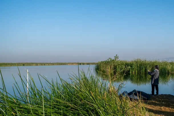
A birdwatcher’s wetland on the city’s edge
Waterfowl and shorebirds are a reason to visit the surviving wetlands, especially during migration and winter. A published study of Texcoco’s bird habitat records northern shovelers, ruddy ducks, American avocets and black-necked stilts. That research predates the new park; it is evidence of the site’s long-standing importance, not a count of birds you will see on a particular day. Bring binoculars and follow the park’s marked visitor routes.
History
Texcoco’s shoreline changed with climate, rainfall and human engineering. Maps from different periods therefore show different lakes. When comparing an ancient map with Mexico City today, check its date before treating the blue outline as the shoreline that surrounded Tenochtitlán.
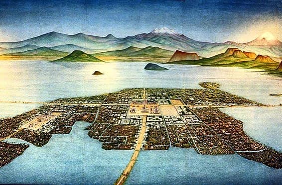
People lived around the basin long before the Mexica founded Tenochtitlán in the fourteenth century. The city’s causeways, canals and dikes linked island settlement, transport and water supply. The illustration below reconstructs the island city rather than showing a surviving modern shoreline.
Could Lake Texcoco come back?
The park restores wetlands and manages water on part of the former lakebed. It is not a plan to flood the modern city or recreate the whole historical lake. The remaining water bodies have different purposes and water levels, so a photograph of one pond cannot describe the entire basin.
Mexico City’s sinking is also more complicated than “the lake was drained.” UNAM explains the role of groundwater extraction: pumping allows the underlying ground to compact. Subsidence varies across the city. Restoring wetland habitat and reducing groundwater pressure are related water-management challenges, but filling a park pond does not reverse urban subsidence.
Beautiful places around
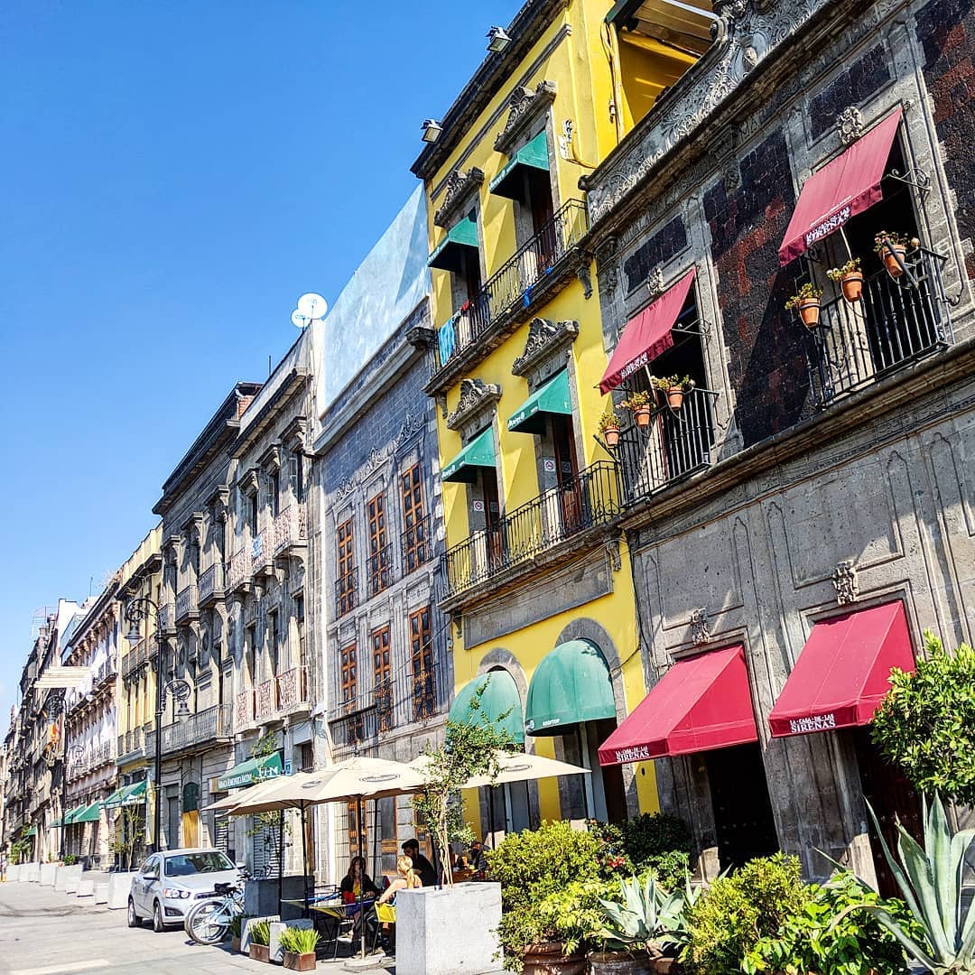
For the history of the island city, start around the Zócalo in central Mexico City. This is the area of ancient Tenochtitlán, several kilometres west of the modern ecological park.
The National Palace faces the Zócalo. Nearby, the excavated Templo Mayor offers a much more direct view of the Mexica ceremonial centre than a modern street map can.
The Templo Mayor Museum and archaeological site explain the buildings and objects found here. Check the museum’s visitor information for admission and concessions. Free Sunday admission is restricted to Mexican citizens and foreign residents.
Visiting the park: hours and two different map locations
The official museum profile, updated 24 April 2026, lists Tuesday–Sunday, 7 am–7 pm, with free admission. Check the park’s official notices before travelling for closures, activities or changes to access. Those hours refer to the park/museum visitor information, not unrestricted access to every wetland.
Modern park and museum
Use the museum location listed by the culture ministry when planning a park visit. Confirm the open entrance and approach with the park before setting off; this point identifies the museum, not a promise that every road drawn across the former lakebed is open.
Historic Tenochtitlán and the Zócalo
For the city’s Aztec history, use the second map. The Zócalo and Templo Mayor are a different outing from the ecological park. Allow for traffic between the centre and the eastern outskirts; a metro ride to Zócalo does not take you to the park.
Frequently asked questions about Lake Texcoco
Does Lake Texcoco still exist?
Yes, water and wetlands remain east of Mexico City, although the large historical lake has been greatly reduced. The present landscape includes managed water bodies and an ecological park.
How deep was Lake Texcoco?
Depth depended on the period and location. The Mexican culture ministry’s museum profile gives 11 metres for the pre-Hispanic lake without specifying average or maximum depth. It is not the depth of today’s park ponds.
Why was Mexico City built on Lake Texcoco?
The Mexica founded Tenochtitlán on an island in 1325. Mexico City later grew over the island and much of the drained lakebed.
Why was Lake Texcoco salty?
The basin had no natural outlet to the sea. Evaporation concentrated salts, while dikes separated fresher water around Tenochtitlán.
Why was Lake Texcoco drained?
Repeated flooding prompted drainage works after the Spanish conquest. The programme began centuries before the Deep Drainage system was inaugurated in 1975, and water engineering continued afterwards.
Can you visit Lake Texcoco today?
Yes. The ecological park has public visitor areas. The official museum profile updated in April 2026 lists free admission, Tuesday–Sunday, 7 am–7 pm. Check the park’s latest access notices before travelling.
Can you see birds at Lake Texcoco?
Yes. The wetlands support ducks and shorebirds, with seasonal changes in species and numbers. Stay on visitor routes and observe from a distance.
What is El Caracol at Lake Texcoco?
It is the large spiral layout of the former Sosa Texcoco salt-evaporation works on the lakebed, rather than an operating lakefront attraction.
Is Mexico City sinking because Lake Texcoco was drained?
Groundwater pumping and compaction of the underlying sediments are major causes of subsidence. Rates vary across the city; restoring some wetlands will not by itself reverse the process.


